Blog
Scanning a breakwater: essential knowledge before embarking on the process
Conducting a high-quality survey of a breakwater is a complex yet crucial task. Reliable data is indispensable for creating a 3D model and validating the structure. Here are the key points to keep in mind.
Why is this survey unique compared to others?
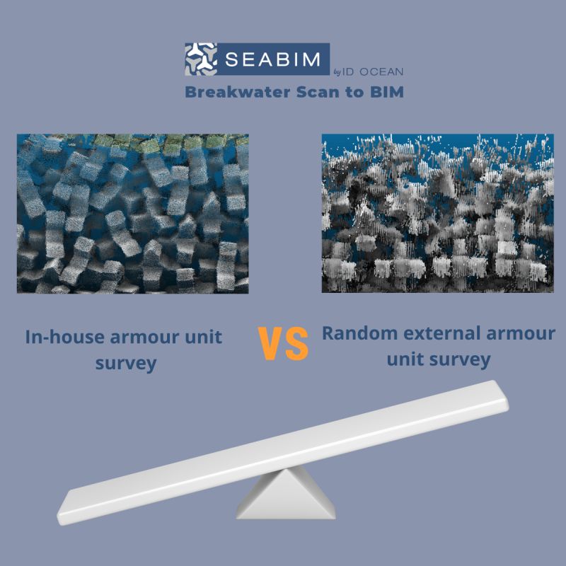
Conducting a survey on a rubble-mound breakwater protected by concrete armour units presents significant challenges. Obtaining high-quality data that clearly delineates each submerged block is difficult. This type of project demands more rigorous methods, settings, and resources than a standard survey.
The primary challenges associated with this type of structure include:
- —Ensuring data continuity between the above-water and submerged sections.
- —Precisely positioning the various survey passes to ensure they fit together correctly.
- —Obtaining sufficient data density for modeling.
- —Navigating safely in the immediate vicinity of the structure.
A scan that may appear correct at first glance, but renders the 3D model completely unusable, is unsuitable for this type of structure. The difference between a good scan and a bad one is sometimes imperceptible, but it's crucial for the next steps.
The three survey methods
Several technologies are employed in conjunction to cover the entire length of a breakwater, each focusing on a specific section of the structure.
Drone photogrammetry (above-water section)
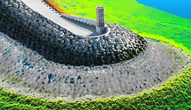
Aerial photographs taken from various angles allow for the indirect reconstruction of a 3D point cloud of the dyke's surface. However, drone surveys may be restricted in certain areas or at sensitive locations. To obtain a point cloud of sufficient resolution, it's crucial to capture images at low altitudes using a high-resolution camera. Additionally, careful attention must be paid to lighting, as a series of backlit photographs can render the model unusable. Mastery of the georeferencing process using Ground Control Points (GCPs) and photogrammetric processing is also essential to ensure the reliability of the point cloud.
LiDAR (above-water section)
A laser scanner mounted on a vessel or an excavator captures the precise geometry of the blocks with a high point density, even in challenging lighting conditions. However, it's crucial to consider the scanner's range limits at the crest when deployed from a vessel. Key aspects to manage include calibration using a dedicated patch test, precise measurement of lever arms, correction for operator movement, and RTK positioning for each pass. LiDAR generates a substantial number of data points, leading to large files. Therefore, it's advisable to manage the recording density and scan only the area where the structure is located.
Multibeam bathymetry (submerged section)
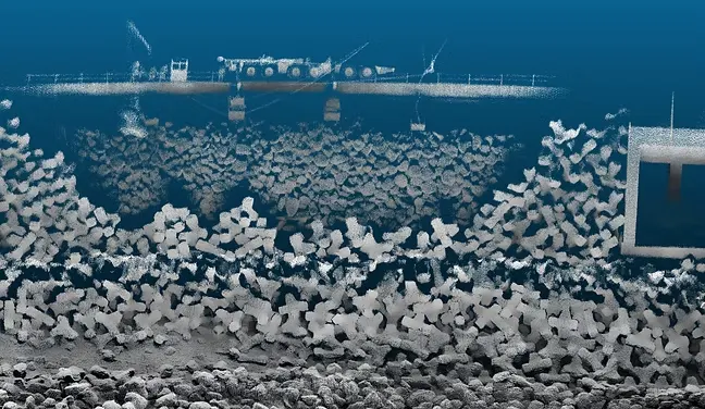
A multibeam echo sounder, equipped with a minimum of 256 beams, a 1°×1° resolution, and operating at 400 kHz, is mounted on a boat or an excavator. This sonar system maps the submerged section of the breakwater, reconstructing its shape block by block. The choice of sonar is crucial, as not all sensors are suitable for underwater structure surveying. Additionally, it's essential to mechanically tilt the sonar towards the slope. Selecting a small, maneuverable vessel capable of approaching within approximately 10 meters of the structure is vital for a successful scan. The survey speed should be minimized, and the echo sounder's range should be set with utmost accuracy. Otherwise, the specific considerations are the same as for a LiDAR survey.
These surveys must be meticulously coordinated, taking tides into account, to ensure a comprehensive dataset devoid of any gaps. The most challenging aspect of surveying lies in the junction between the above-water and submerged sections, particularly around the waterline. In regions with a limited tidal range, a data gap of approximately 50 cm to 1 meter may arise. Nevertheless, it is feasible to construct a 3D model of this section, as a partial view of the block, whether submerged or above water, suffices to determine its position.
How this affects you depending on your role
Construction companies & project owners
❌ Opting for the cheapest contractor rarely results in satisfactory outcomes and can lead to significant challenges in maintaining the quality of the construction.
✅ Alternatively, you can conduct these surveys in-house, provided you have a qualified team and the necessary equipment.
Surveying firms
❌ This type of project should not be treated as a routine survey.
✅ You must continuously review your methods and adhere to rigorous standards at every stage, from project preparation to data processing.
High-quality data for a reliable model
The data collected in the field is directly integrated into the 3D model generated by SEABIM. This model is then used to validate the placement of the blocks and monitor the structure over time. The logic is simple: poor-quality data leads to a poor-quality model, which cannot be used for any validation.
Consequently, the quality of the survey is not an adjustment variable — it is the starting point for everything else.
How SEABIM can support you
Drawing on years of international experience in this field, we offer a comprehensive range of services to optimise your survey processes.
- —Audit your existing processes to enhance the quality of your scans.
- —Assist you with the installation of your equipment and train your teams.
- —Conduct surveys directly on-site using our own team and specialised equipment.
Conclusion
A high-quality 3D model is the result of a meticulously prepared and executed survey conducted on-site by professionals with expertise in such projects. This crucial stage is often overlooked, but it plays a pivotal role in the project's overall success.
More articles
May 2026
How did CLI change their process for validating breakwater armor units using a 3D digital twin?
For years, validating the compliance of breakwater armor layers demanded the full-time presence of an on-site diver inspector. CLI (Concrete Layer Innovations) revolutionized this process by adopting a 3D digital twin approach — cutting costs and redefining inspection standards.
April 2026
How can 3D digital twins improve monitoring of breakwaters?
Breakwaters protect ports and coastal areas from swells and flooding, but monitoring them remains a major technical challenge. With climate change and more frequent extreme weather events, monitoring breakwaters has become critical. New solutions are emerging, notably 3D digital twins.